Some of the places that Rob and William visited on route to Edlingham
Warning!
Spoiler Alert
Brinkburn Priory
Built in the 12th century, Brinkburn Priory is in a wonderfully tranquil location on a bend in the River Coquet. It is accessible by a wood-shaded road that runs south from the B3644.
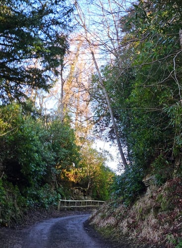
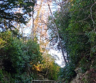
The tree-lined track that offers Corbin some protection from the rain as he rides to Brinkburn. in the story I imagine the track to be more heavily wooded, and, as the action takes place in the summer, the foliage on the trees would be much denser. (This photograph was taken in February).
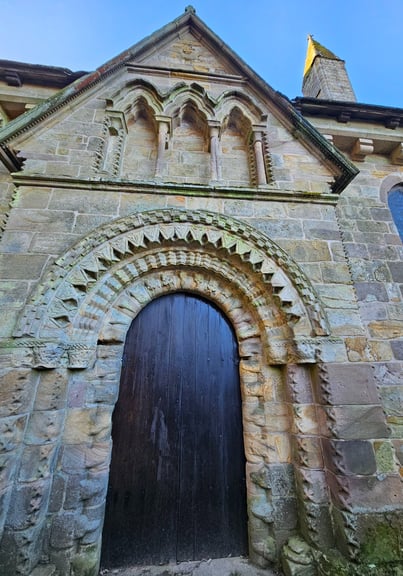
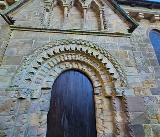
The imposing North door where the Prior bars Corbin from further entry
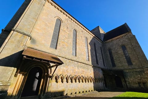
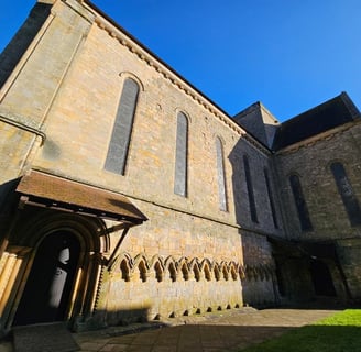
The South door and what remains of the covered cloister.
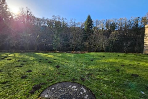
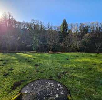
The sward leading down to the river. I imagine Rob standing here gazing down towards the river, which runs down the bank just past the trees.
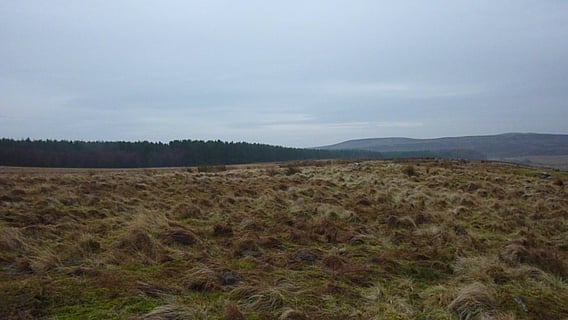
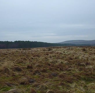
This is where Rob and William begin their journey. They head south here to the river and then roughly west towards Rothbury and Paperhaugh bridge.
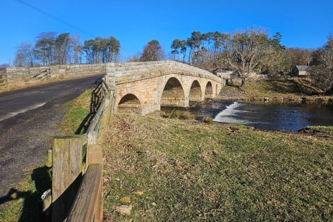
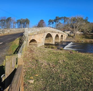
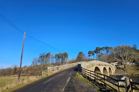
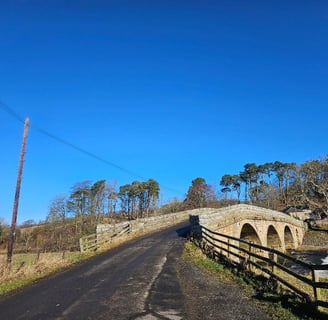
Paperhaugh bridge
I've always loved this little bridge. The current bridge is relatively modern, having been built in 1862, however, when I was younger it always seemed medieval, and that how I chose to imagine it in Rob's story.
"A single sentinel stood at the centre of the span, gazing out along the river; fortunately, the man had his back to Rob and so hadn’t spotted him."
This is the view that the sentry would have had as Rob sneaked up behind him
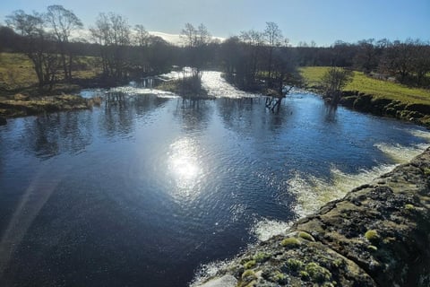
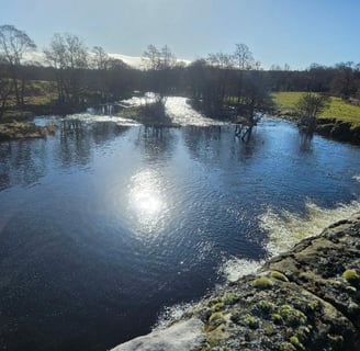
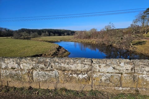
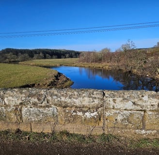
From the bridge looking back towards Brinkburn. Rob and William would have followed the river always making sure it was on their right
The southern approach to the bridge. In my imagination the roadway is a track rather than the modern tarmac surface.
I also imagine the parapet continuing down where the wooden fence now is. This would give Rob some cover as he climbed onto the bridge at a point where the road sweeps around to the right.
The 'Cup and Ring' stones and the deserted village
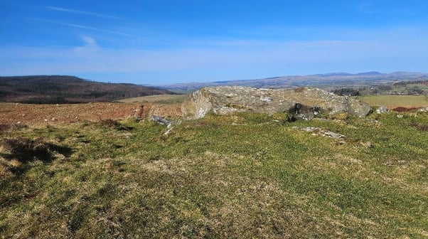
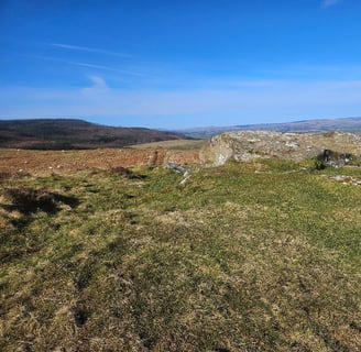
I've cheated here and moved the stones further East than where they really are (on the moors above Rothbury).
I've based the deserted village on Lordenshaw and also moved it East.
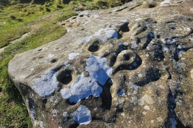
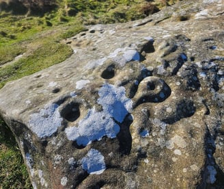
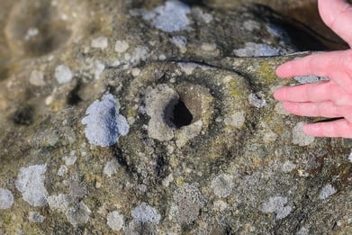
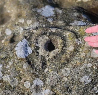
I find these Cup and Ring marks fascinating and felt that they deserved a place in the narrative. They can be found all over Britain and Ireland and although nobody knows for certain what they were, the general consensus is that they date back to the Bronze Age.
Note. My hand is included to give a sense of scale.
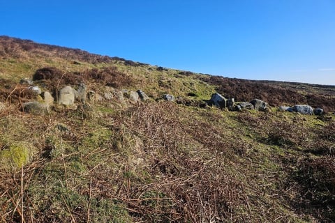
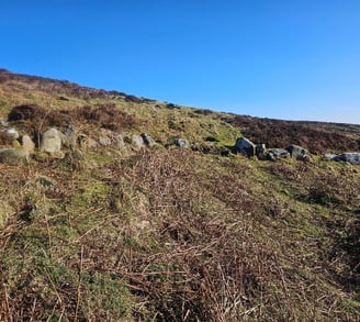
Lordenshaw is a long abandoned and ruined Iron Age hillfort above Rothbury.
As I've said I've used it as a basis for my much later abandoned medieval village (and moved it East).
There are a number of abandoned medieval village sites in Northumberland, so I thought adding another wouldn't be such a sin. The village I invented would have been quite wealthy at one time, with some stone built buildings, and it ceased to exist as a consequence of the plague.
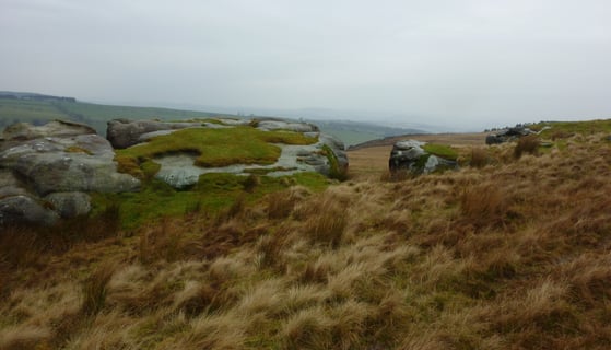
The moor above Edlingham
Where Corbin finally catches up with Rob and William
This is the moorland above Edlingham, looking east towards the course of the Devil's Causeway. In the near distance is the pine wood where Corbin led his men to shelter from the rain.
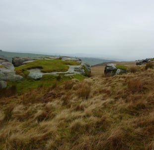
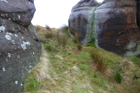
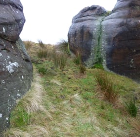
This is the gap in the rocks that Rob made for once he realised that Corbin was about to ride them down.
The slope where Rob unhorses the first rider and kills the second.

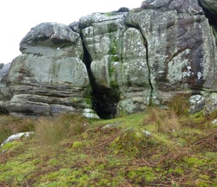
The site of the cave where Rob sends William while he encounters Corbin and his remaining horseman, and the spot where Armstrong confronts Corbin.